Advertise Online
–
SEO - Search Engine Optimization - Search Engine Marketing - SEM
– Domains For Sale
– George Washington Bridge Bike Path and Pedestrian Walkway
– Corona Extra Beer Subliminal Advertising
– Outlaw Motorcycle Gangs
– Pet Care
–
The Tunnel Bar
–
La Cosa Nostra
–
Jersey City Free Books
Jersey City And Its Historic Sites
By Harriet Phillips Eaton
Published 1899
This Web version, edited by GET NJ
COPYRIGHT 2002
Forming the City
In the map of the new city prepared by the Associates, the streets were laid out at right angles and one thousand three hundred and forty-four lots were laid down. The eastern boundary was Hudson street, which was laid in the water with the exception of a small piece of upland that extended outward at Morris street. The southern boundary was South street, later called Mason street, and a few years ago vacated by the city. Harsimus was the northern boundary. It was nearly circular upland, of which the greatest extent was from one hundred feet north of Montgomery street to one hundred and seventy-five feet south of Essex street. More than half of the site for the proposed city was marsh and land under water. The westerly boundary was a line drawn from the east side of South street to a point near the corner of First and Washington streets. It was the plan of the Associates that the western border should front on a tide water canal, an island city, bordered by piers and docks and surrounded by navigable water. The Jersey City Journal's History of Jersey City claims that the city has lost commercial prestige by the failure to carry out that idea, also that another and even greater blunder was committed by the filling in of Mill Creek, which had been navigable by small sloops. The new city met with many discouragements; New York claimed jurisdiction over all lands under water up to low water mark on the Jersey shore. Alexander Hamilton and Joseph Ogden Hoffman, as counsel to the Associates, gave a guarded answer that New York had no right to land under water at Paulus Hook. This boundary dispute was not settled until 1889. Mr. Van Vorst would not accept an equivalent for the annuity, which affected deeds and prevented many from purchasing the lots.
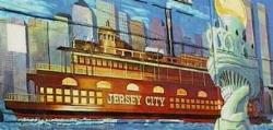
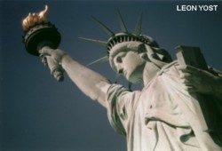 The Statue of Liberty, Ellis Island, and The Central Railroad Terminal
Visit Liberty State Park!